Antelope Island Self-guided Field Trip Investigation Report
Antelope Island State Park has unique geological evidence that is very well preserved. The rock formations range from millions to billions of years old. This paper will include findings and discussion on landforms and other geological elements on the island including formations at Bridger Bay, White Rock Bay, hillsides east of Beacon Knob, Dooly Knob, and Frary Peak. Also included in this research and discussion are Lake Bonneville, and the natural resource usage in recent and early settlement history of the island.
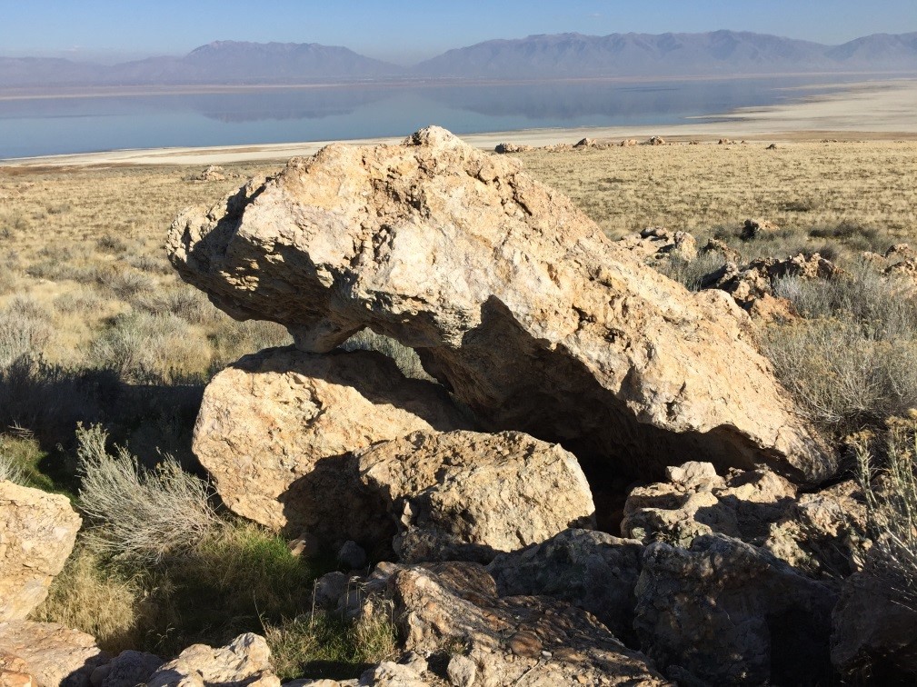
In the Bridger Bay area located at the north end of the Island I observed rough rocks, tan and grey in color, and appeared to be cemented together (figure 1). This type of rock covers a large portion of the area. I concluded that the rocks were Tintic Quartzite integrated in a conglomerate of younger sediments. These formations are believed to be deposited in a shallow marine ecosystem. The Tintic Quartzite in this region are approximately 540-570 million years old which dates back to the late Cambrian period (Yonkee, 2000). Quartz sandstone undergoes metamorphism when exposed to increased temperature and pressure. Over geologic time, this creates quartzite such as the ones I examined in the field.
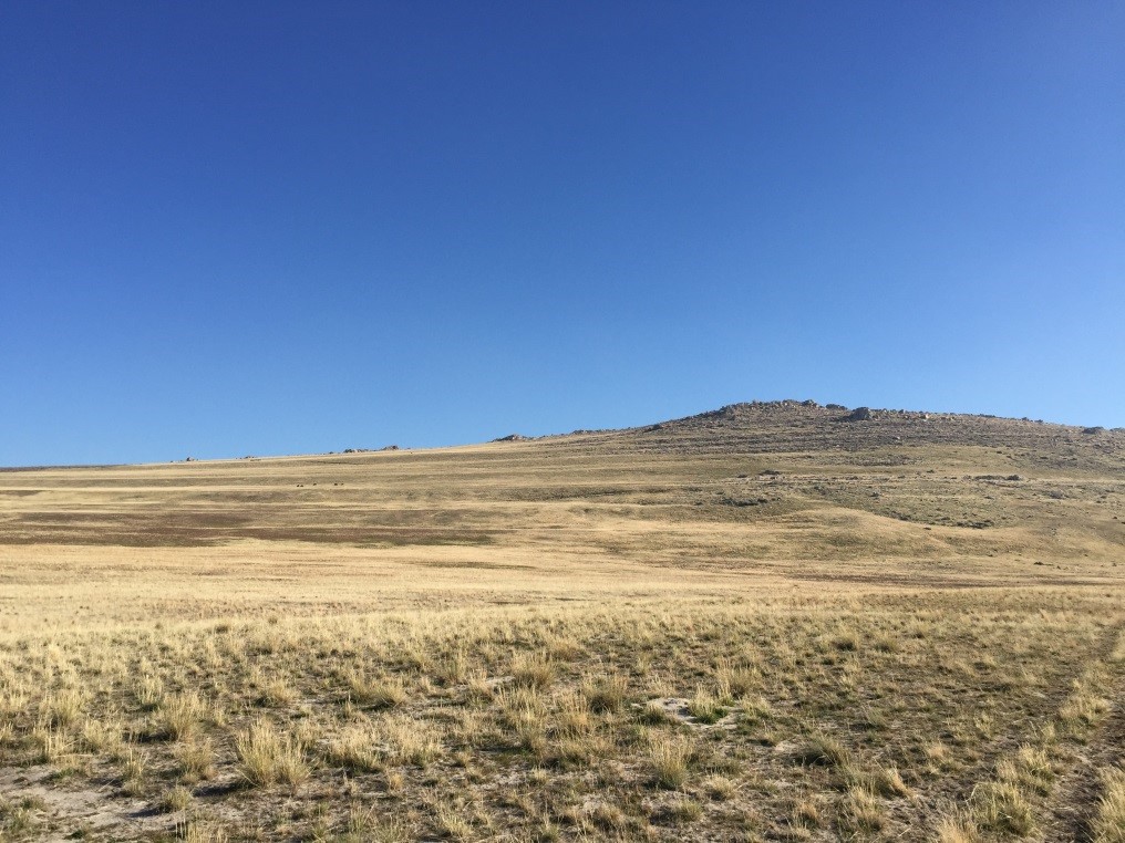
The next area I explored was White Rock Bay. There are terraces on the hill side of the bay that can clearly be seen (figure 2). Each terrace represents the receding shorelines of ancient Lake Bonneville which according to Oviatt et al. (1992) covered the area between 30,000 and 12,000 years ago. Another observation that I found intriguing in this region of the island is the western shoreline and beaches of White Rock Bay. They are very unique with the sand granules being round or egg-shaped and have a slippery texture. This is called oolitic sand. The way this is typically formed is by the deposition of calcium carbonate around fecal matter from brine shrimp or small shell fragments.
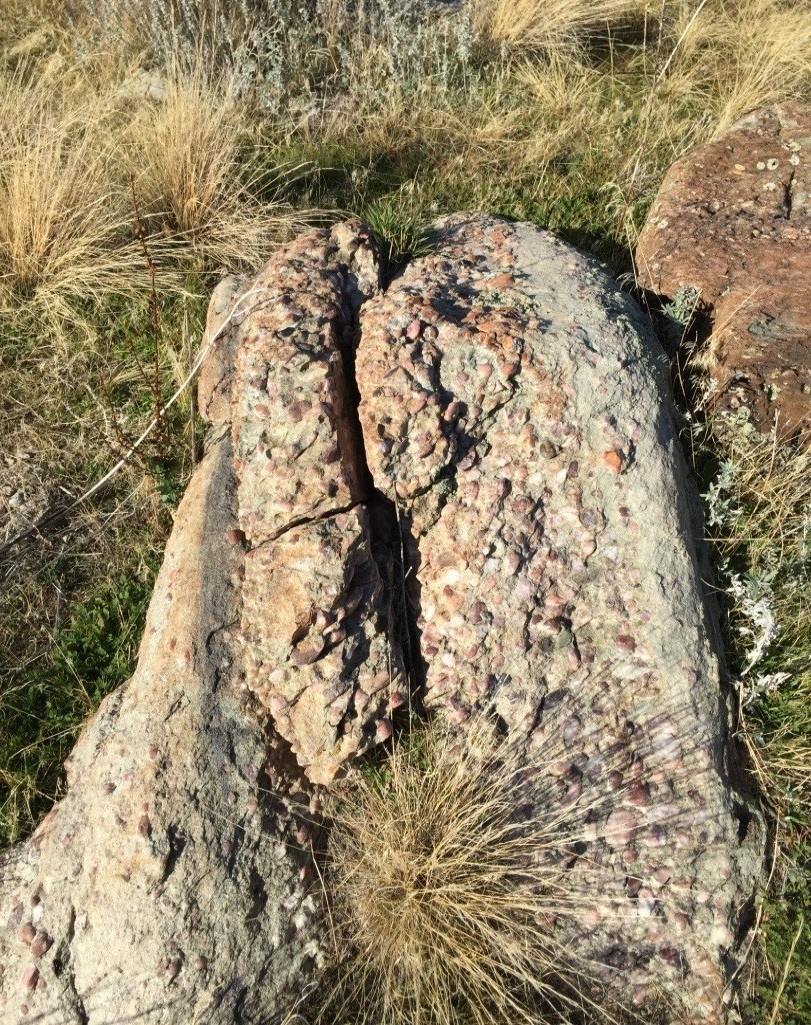
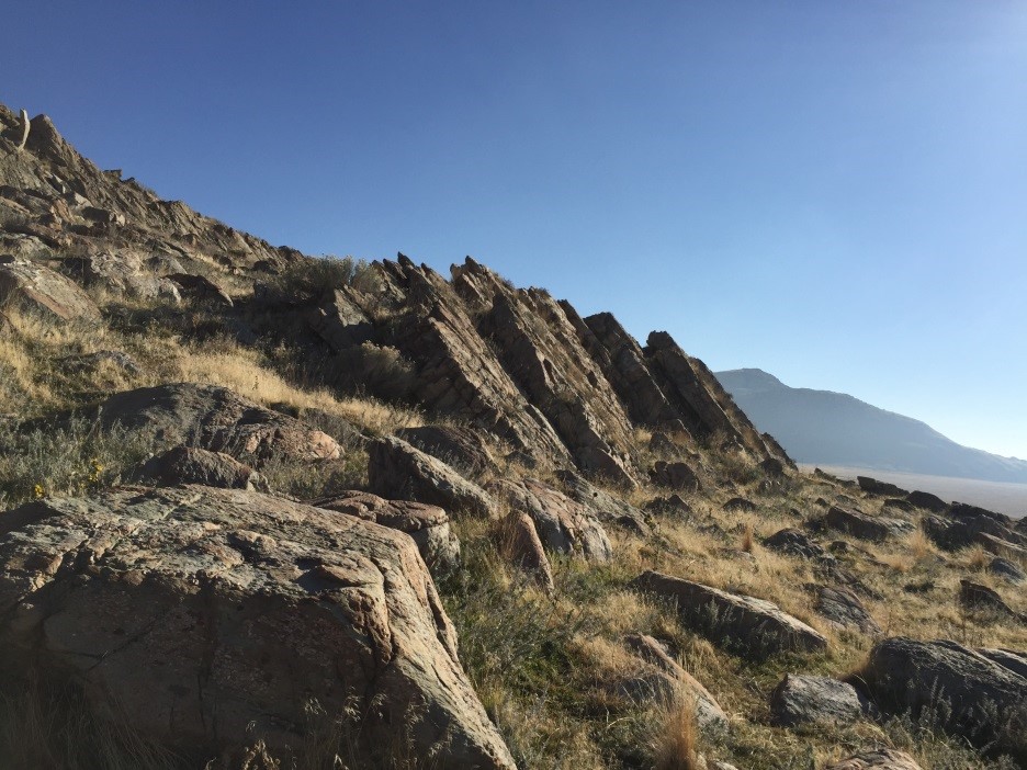
Another area I investigated was the slopes of White Rock Bay which consist mainly of conglomerate rock formations (figure 3). These conglomerates contain large amounts of quartz, and some contain white quartz or dolomite veins. Many of these rocks are uplifted at an angle towards the east (figure 4). This gives evidence of faulting and seismic activity. Several faults runs along the west side of the island, which is likely the cause of this uplift and is evidence of seismic activity. At least three faulting events in the Great Salt Lake have been confirmed post Lake Bonneville. Advancements in seismology have allowed researchers to verify a displacement of twelve meters along the lake faults (Coleman, 2002).
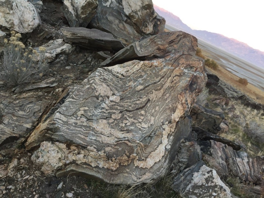
The hillsides southeast of Beacon Knob was the next area I explored. It contains scattered Tintic Quartzite and Granitic gneiss rock. One distinctive feature of gneiss is its layered minerals that create a banded or striped effect. The bands within the rock consist of different minerals that align together under compression. These compressional forces can also foliate or contort the rock which can cause it to swirl and curve (figure 5). These are some of the oldest rocks in the state of Utah dating back 2.7 billion years. The majority of Antelope Island is made up of gneiss which falls into the Precambrian era (Mayo, 1991). However, most of the rock is not visible because it is overlaid with younger sedimentary rock formations. Just below Dooly Knob are large block diagonal uplifts of gneiss. These clusters of rocks are pinker in color and are not as distinctly foliated as the gneiss found below Beacon Knob.
Naturally occurring springs are abundant throughout the island. Most of them are located at higher elevations. Over time these springs or the springs’ runoff cut through the landscape eroding away material that helped create the canyons and gullies we see today (figure 6). Below Frary Peak, on the east side of the island I observed that some of these springs go underground and then resurface at a lower elevation. This created marsh lands which supports more abundant vegetation than some parts of the island.
Antelope Island has been used for its natural resources since the Salt Lake Valley was first settled. Some of these natural resources include gold, silver, copper, slate and salt. In more recent years, state workers removed over 16 million cubic yards of sediment from the southeast side of the island. This material was used in the interstate highway construction project (NNR, 2016).
The geology of Antelope Island is extremely diverse having some of the oldest and the youngest rocks in the state of Utah. This made it an interesting location for this self-guided field investigation. As I explored the island I was able to identify and understand most of the geologic landscape and elements based on what I have learned in class. Actually going out into the field and physically experiencing the geology first hand was invaluable and enjoyable. My favorite rock formations on the island was the Gneiss because of its’ age, and overall beauty. Another landform that I thought was fascinating was the terraces created by the ancient Lake Bonneville. On the north side of the island these terraces were very distinct and drew my attention. Although I spent nearly an entire day on Antelope Island, I was still not able to observe all of the interesting geological features that I wanted to, due to its vast area. I plan on returning to the island soon so I can further my knowledge and witness all that it offers.

Colman,
S. M., Kelts, K. R., & Dinter, D. A. (2002). Depositional history and
neotectonics in Great Salt
Lake, Utah,
from high-resolution seismic stratigraphy. Sedimentary
Geology, 148(1),
61-78.
Mayo,
A. L., & Klauk, R. H. (1991). Contributions to the solute and isotopic
groundwater geochemistry,
Antelope
Island, Great Salt Lake, Utah. Journal of Hydrology, 127(1-4), 307-335.
Oviatt,
C. G., Currey, D. R., & Sack, D. (1992). Radiocarbon chronology of Lake
Bonneville, eastern
Great Basin,
USA. Palaeogeography, Palaeoclimatology, Palaeoecology, 99(3-4),
225-241.
Utah Division of Natural Resources (DNR). (2016),
Antelope Island State Park, Retrieved November 15,
2016 from http://stateparks.utah.gov/parks/antelope-island/antelope-island-mining/
Yonkee, W. A., Willis, G. C., &
Doelling, H. H. (2000). PETROLOGYAND GEOLOGIC HISTORY OF THE
PRECAMBRIAN FARMINGTON CANYON
COMPLEX, ANTELOPE ISLAND, UTAH. The geology of
Antelope
Island, Davis County, Utah, (1),
Antelope Island State Park contains many significant and unique geology that I never paid attention to until I took this geology class. During my self-guided field investigation, I was able to take what I learned in the class room and apply my knowledge out on the Antelope Island. The island is very large being 43 square miles and geological features aren’t just in one area, they were spread throughout the whole island. Because the area was so large and the sun sets earlier in the fall, I was unable to examine everything I wanted to. If I were to change the way I went about finding the geology on Antelope Island, it would be to start right when the park opens, or split up the trip in two days. I still plan on returning to the island on my own time to explore and examine its fascinating geological features and landforms.